| Tutorial chapters: |
|
 |
|
 |
|
 |
|
 |
|
 |
|
 |
|
 |
|
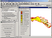
 What would be the consequences of the two zoning plans in the future? We can use Geographic Information Systems (GIS) modelling to simulate future impacts. This is called a "buildout" analysis.
Buildout models are used to predict the potential for urban development in a defined area (in this case Fletcher's Folly).
We can get two major results from our buildout modelling analysis:
- Aerial views at buildout.
- Comparative statistics on indicators, such as impervious surface area.
Let's see simulated aerial views of Fletcher's after buildout. 
