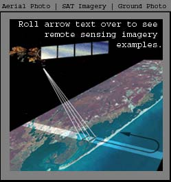
 Remote Sensing is the science of recording information on something without physically touching it. An example of remote sensing is a birdwatcher who can follow bird movements / behavior with a pair of binoculars without physically touching the bird. In this instance the remote sensing platform is your eyes recording information on the color, movement, texture, and size of the bird.
Remote Sensing technologies in the JC NERR are used to observe the entire reserve on a synoptic level in a timely fashion. This is quite important as the reserve system covers approximately 114,000 acres of dynamic environment. In order to monitor this area the JC NERR uses several different RS data sources with different properties to obtain information on how the environs are changing. For example, we used it to document the amount of human development that had occurred within the boundaries of the reserve since 1995. This was done by comparing aerial photography taken in 1995 to satellite imagery taken in 2000. In order to verify that the interpretation of the imagery was correct field checks were accomplished by visiting some of the areas on the ground. Click on the rollover imagery on the right to see a graphical example of this project. The aerial photography show forested areas being intersected by a roadway. The bright areas on the satellite imagery represent newly developed areas. Notice that the aerial photography in this case is in color and the satellite imagery is in black and white.
