Main Content
Wetlands and Water Levels Monitoring
The purpose of the Jacques Cousteau NERR long term monitoring is to document and respond to emerging environmental changes that impact the natural and human systems of the Mullica River-Great Bay and Barnegat Bay estuaries. The JC NERR is focused on long-term monitoring and research to track changes in abiotic parameters, range shifts in habitats, and the marsh pond ecosystems. To this end, biomonitoring surveys, marsh elevation and emergent vegetation mapping, and the acquisition of vegetation health metrics are ongoing to characterize vital spatial-temporal changes in the marsh system.
The Tuckerton Peninsula is a 5,000-acre Spartina salt marsh system that separates the Barnegat Bay-Little Egg Harbor and Mullica River-Great Bay estuaries in New Jersey. It is also the designated Wetlands and Water Levels Monitoring site of the Jacques Cousteau National Estuarine Research Reserve (JC NERR) for the detection and monitoring of climate change effects, such as coastal habitat responses to sea level rise, major storms, and inundation.
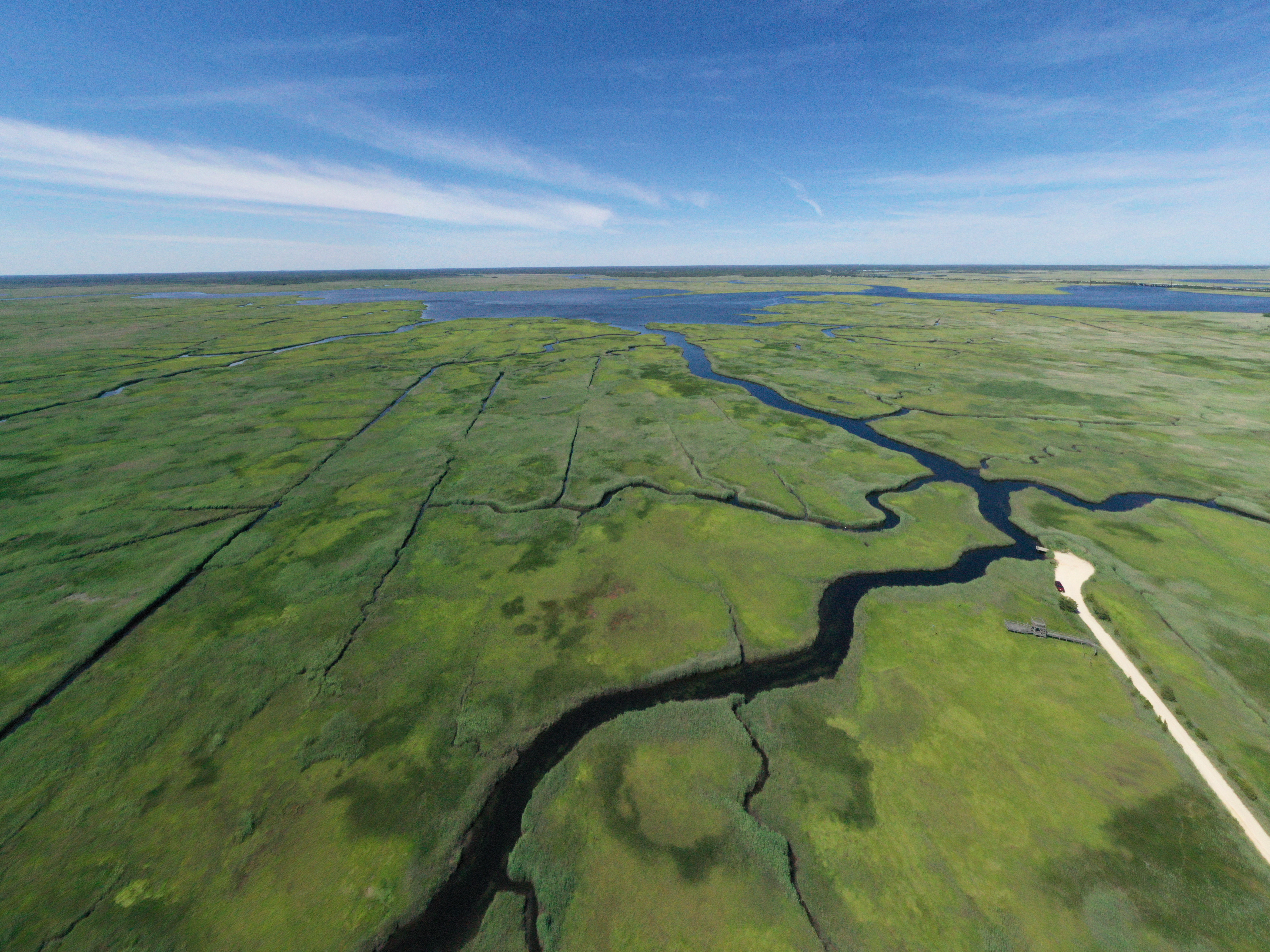
The JC NERR site is part of a coastal network of sentinel sites established by NOAA’s National Estuarine Research Reserve Program to understand the short- and long-term trends in coastal marsh condition locally, regionally, and nationally. One major goal is to assess the sustainability of the Tuckerton Peninsula salt marsh to climate change effects which will generate vital information for New Jersey’s coastal communities. This important marsh habitat is a protective buffer that reduces the vulnerability of coastal communities to sea level rise, storm surge, and flooding. It also provides an array of other ecosystem services including groundwater storage, contaminant filtration, biogeochemical cycling, carbon sequestration, habitat formation (for fish assemblages, bird populations, and other biota), and migratory pathways (for shorebirds, horseshoe crabs, and other sensitive species that rely on the marsh system for survival).
Surface Elevation Tables (SETs)
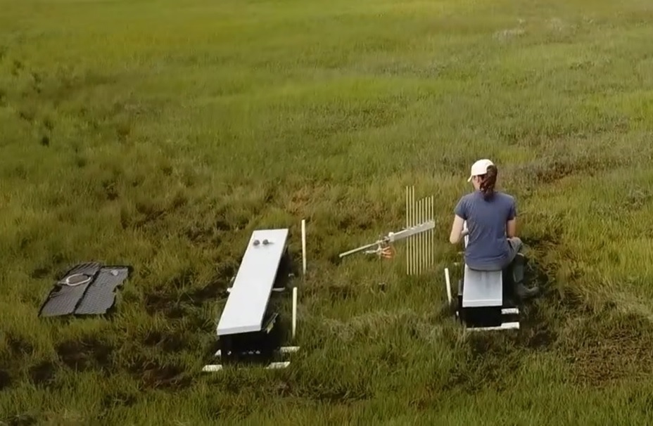
Seventeen surface elevation tables (SETs) have been installed on the Tuckerton Peninsula salt marsh to measure salt marsh elevation change relative to local sea level. They have been installed adjacent to nine vegetation monitoring transects where the composition and health of marsh plant communities will be examined periodically in response to climate change effects.
Surface Elevation Models
Digital elevation models have been generated using Real Time Kinematic GPS (RTK) in the three salt marsh segments. These measurements will be repeated on a regular basis in future years to document broad surface elevation change over consistent temporal intervals and to augment fine-scale surface elevation change data obtained using SETs.
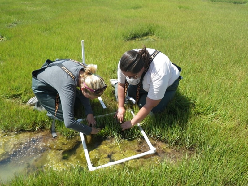
Vegetation Transects and Monitoring
Comprehensive emergent vegetation monitoring of the Tuckerton Peninsula salt marsh system in the JCNERR started in 2011. Nine permanent transect lines have been established in three salt marsh segments (north, central, and south): Transects 1-3 (north segment), Transects 4-6 (central segment), and Transects 7-9 (south segment). Monthly quadrat sampling during peak salt marsh biomass periods (June – September) were conducted at each of 90 plots along these 9 transects.