Main Content
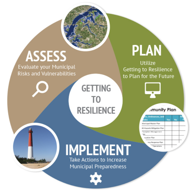
Getting To Resilience Community Planning Tool
This self-assessment process helps communities reduce vulnerability and increase preparedness by linking planning, mitigation, and adaptation. The assessment indicates where certain preparedness actions can be worth points through FEMA’s Community Rating System and the Sustainable Jersey program.

Whole Community Coastal Climate Resilience Planning Training
The goal of this training is to improve coastal resilience planning by incorporating the needs of populations that are especially vulnerable to changing climate conditions, many of whom are historically underrepresented in civic decision-making. The target audience is any professional, elected, or appointed official or community leader engaged in coastal planning at the state or local level.
Municipal Snapshots
Available for each of New Jersey’s municipalities, these reports provide easy access to information about the people, places, and assets at risk from climate impacts. Snapshots are available summarizing flood exposure for built infrastructure, critical assets, natural and working lands, public health facilities, and vulnerable populations.
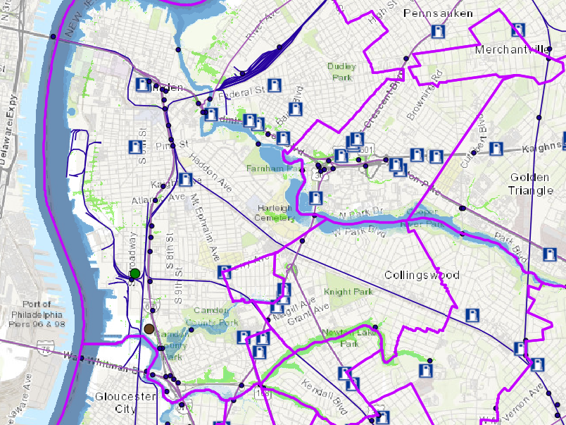
NJFloodMapper
NJFloodMapper is a public web-based decision-support tool to visualize flood risk from sea level rise and coastal storms. Developed by Rutgers University and JC NERR with partner institutions and agencies, NJFloodmapper streamlines multiple datasets and tools into a single state-specific resource to aid coastal resilience planning in New Jersey.
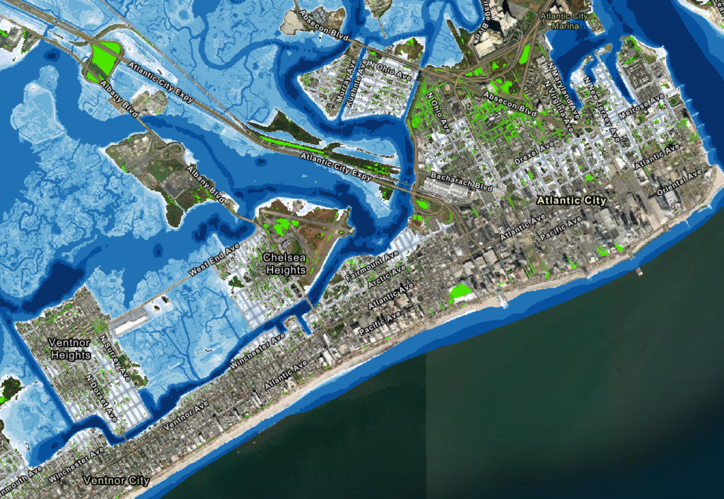
NJFloodMapper features:
- A unique Total Water Level approach through which user-defined combinations of sea level rise and flood conditions can be used to evaluate a range of flood scenarios and timeframes.
- Data layers showing infrastructure, land uses, socio-demographics, and more to assess community vulnerability.
- Municipal Snapshots with summarized flood exposure information about people, places, and assets in each of New Jersey’s municipalities.
Learn more about the NJFloodMapper development process here.
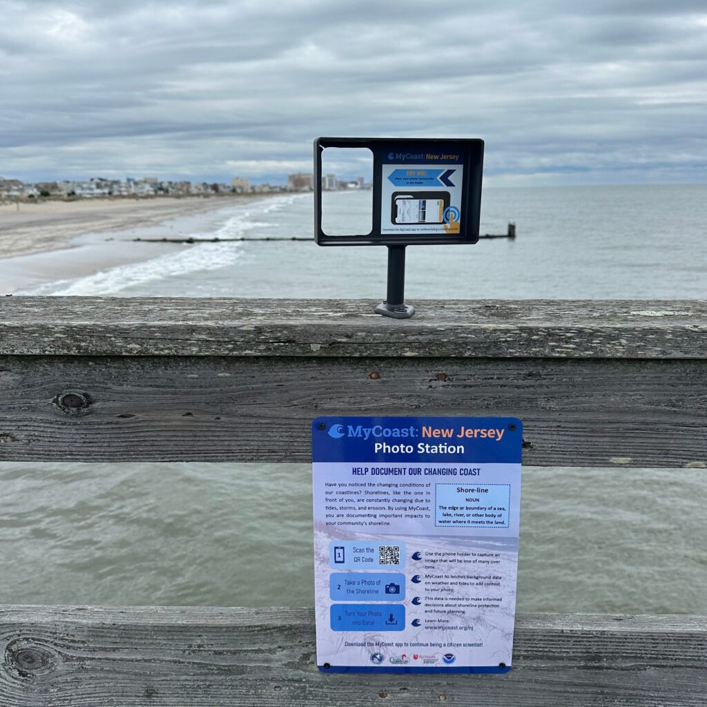
MyCoast: New Jersey
With funding from NOAA and the NJ Coastal Management Program, NJDEP and JC NERR became the tenth coastal state nationwide to establish a MyCoast portal. MyCoast collects and analyzes crowdsourced photos of coastal events and places. Photos are automatically linked to data about weather and tides to create reports that help stakeholders understand coastal change and make informed decisions. The New Jersey MyCoast portal currently includes three photo collection tools – high water events, valued coastal places, and Photo Station shoreline monitoring – additional tools will be added soon.