Main Content
National Benthic mapping strategy Workshop JC NERR Research, SWMP, and Stewardship staff hosted and participated in a workshop to develop recommendations for how NERRs, individually or collaboratively with a view towards inter- and intra-regional comparison, could pursue mapping of submerged habitats in complement to the sub-areal mapping and vegetation inventories that are part of the reserve profiles and also provide a tool for inquiry into estuarine processes such as sediment transport, perturbation, animal habitat use, and hydrological drag relevant to understanding buffering effects. The workshop included discussion on technology, strategy and approach, habitat classification, costs, and access. A brief report is here.
Autonomous Vehicles
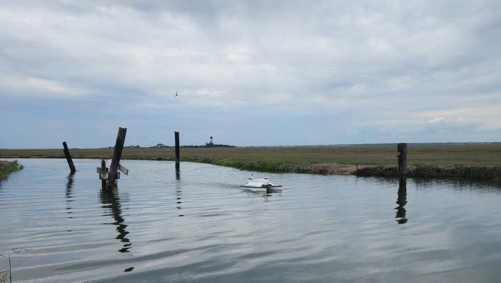
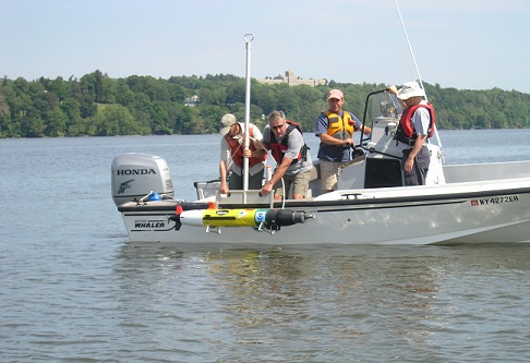
Two types of robotic vessels, an Autonomous underwater vehicle (AUV) and an autonomous surface vehicle (ASV) are owned and operated by the JC NERR’s Coastal Undersea Research Program (CURP). Both serve as platforms for sampling and mapping submerged habitat but are also test platforms for trying new technologies and strategies. The Sea Robotics Surveyor 1.8 ASV, acquired in 2024, is optimized by hull design and sonar type (multibeam bathymetric and 540/1600 kHz dual frequency interferometric side scan sonar) to map shallow areas (intertidal to about 10 m depth). It has seen immediate application in support of basic mapping jobs in the JC NERR, and in supporting fish habitat studies here and in neighboring estuaries including the Hudson River and Waquoit Bay (for WBNERR). It is also being used to generate test maps for the development of AI tools to improve benthic mapping and for training /workforce development through the NJCCRC programs and Rutgers Masters in Ocean Observing Program. The REMUS 100 AUV is a 1.6 m long torpedo-shaped submarine optimized for deeper water work (10 – 100 m) and is a long standing workhorse for deeper estuarine and coastal ocean sensing jobs. Developments tested on the platform include o development for mapping benthic habitats (as above), methods for High-frequency side-scan sonar fish reconnaissance , and payload control systems for improving acoustic telemetry of fishes and their applications.
Ongoing projects using these tools include:
The Development of Techniques for Tropical Seaweed Cultivation and harvesting
The use of an AUV is piloted for the assessment of environmental conditions and growth of Euchemia algae on an estuarine farm consisting of suspended, seeded rope. Work was requested by partner Marine Biological Laboratory for prime Advanced Research Projects Agency-Energy (ARPA-E).
Effects of Sand Mining for Beach Nourishment on Living Resources
Beaches along the barrier island split communities of New Jersey are nourished from sand extracted from relict ebbtide deltaic deposits (submerged shoreface sand ridges). The effects of sand extraction on commercially and recreationally important fishes as well as horseshoe crabs is being studied through a combination of sonar, hydrographic sensors from a propelled AUV and gliders, trawling, and acoustic telemetry.
NJ Coastal Consortium for Resilient Communities (NJCCRC)
The JC NERR and Rutgers University are part of the NJCCRC Partnership to build a Barnegat and Great Bays Resilience Observing Network. The team is identifying data and knowledge gaps to inform future research, monitoring and modeling needs to observe underwater habitats using AUV and ASV technologies. Through this project we will gather the necessary community input that will identify specific characteristics of such an observing and modeling network for this representative coastal system, the Barnegat and Great Bay estuaries. This information will inform predictive models that are needed to inform the management of estuarine resources, specifically how fast and in what ways changes are occurring. Models of changing ecosystem dynamics and range shifts in habitats and species will enable forecasts of future predicted changes. In turn, these data can lead to the informed, proactive management of coastal resources in anticipation of future environmental change. Such a capability will require a strong partnership with the observing/modeling community and natural resource managers, additional resources, and a science to management network strategy that is locally responsive to management needs and climate change impacts.